Localised Persistent Convective Development Causing Air Traffic Disruptions in Hong Kong on 30 May 2010
|
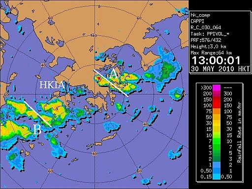
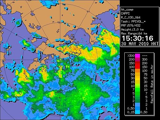
On 30 May 2010, severe localized thunderstorms affected Hong Kong and its nearby regions. Significant convection developed over Sai Kung (marked with A in Fig.1) and the southwestern part of the Lantau region (marked with B in Fig.1) affected the arrival and departure flight paths of the Hong Kong International Airport (HKIA) respectively, forming literally a "wall" blocking the air traffic in and out of the airport. The active convective development persisted over the regions for about three hours in the early afternoon (Fig.2). During the event, the movements at HKIA were severely reduced from 1300 HKT (0500 UTC) onward due to severe weather on the flight paths and consequently it caused significant delay to flights at HKIA for the rest of the day. This case highlighted the significance of weather impact to air capacity, especially for busy terminals. It also revealed the importance and the pressing need for accurate weather forecast and closer collaboration between meteorological service and air traffic management to mitigate these situations. |
|
Figure 1 Radar image for Hong Kong at 1300 HKT on 30 May 2010
Figure 2 Radar image for Hong Kong at 1530 HKT on 30 May 2010 |