Landing with a bump at Taipei Taoyuan International Airport during Tropical Cyclone Kong-rey
4 November 2024
Leung Yan Yu Christy, Kok Mang Hin Marco
A Starlux Airline JX871 departed Okinawa on 31 October 2024 and was originally scheduled to arrive Taipei at 08:20 UTC. In the same afternoon, Tropical Cyclone Kong-rey made landfall over Taitung province and the associated high winds and convective clouds affected most parts of Taiwan. Due to low visibilities and significant wind shear conditions at the Taipei Taoyuan International Airport (TPE), the aircraft had entered into a hold before making its final approach (Figure 1). The aircraft made its first attempt to land at 09:34 UTC, but bounced upon touching the runway and leaned towards the left with its wingtip nearly touched the runway (Video 1). The pilot then decided to go around. In the second landing attempt, the aircraft landed successfully.
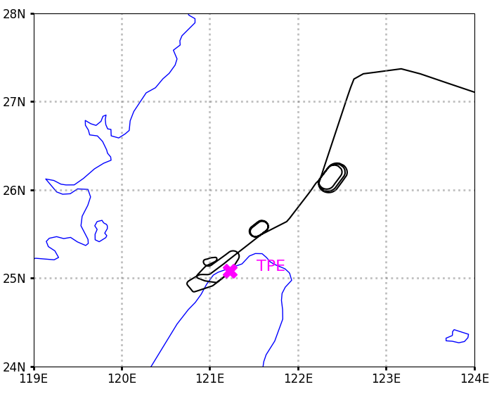
Figure 1: Flight path of JX871 arriving Taipei (Data source: RadarBox)
Video 1: The first and second landing attempts of JX871 (Source: ShanghaiEye YouTube channel)
METAR of TPE on 2024/10/31, 09:30 UTC and 10:00UTC
- METAR RCTP 310930Z 08039G55KT 9999 -SHRA FEW010 SCT025 BKN080 27/25 Q0986 WS ALL RWY NOSIG RMK A2914=
- METAR RCTP 311000Z 08044G58KT 9999 -SHRA FEW010 SCT025 BKN120 27/25 Q0986 WS ALL RWY NOSIG RMK QFF 986.4HPA A2913 RA AMT 0.2MM=
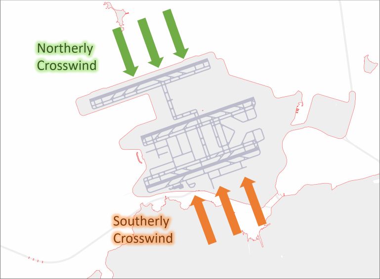
Figure 2: Schematic diagram of crosswind at the runways of HKIA
When a tropical cyclone approach Hong Kong and pose an impact to air traffic at HKIA, the Hong Kong Observatory (HKO) will conduct special weather briefings for the aviation community at HKIA with the latest assessment of weather forecast, including the forecast of crosswind. Additionally, HKO will also issue wind shear and turbulence alerts and warnings for the aviation community utilising the network of detection systems installed around the HKIA, including the Terminal Doppler Weather Radar, Light Detection and Ranging (LIDAR) systems, wind profilers and a dense network of surface wind sensors. If, unfortunately, you are flying from or to an airport that might be affected by tropical cyclones, please be advised to check with the airlines for the latest flight information before travelling to the airport.