Data from Tai O Tide Station added to "Tidal Information" webpage
2 November 2018
Real-time tide measurements from the Tai O Tide Station operated by the Drainage Services Department have been added to the "Tidal Information" webpage of the Hong Kong Observatory since 16 September 2018 for enhancing the tidal information services and monitoring of the tidal variation at various locations in Hong Kong. The "Tidal Information" webpage is jointly operated by the Observatory, Marine Department, Drainage Services Department and Airport Authority of Hong Kong. The latest tide observations recorded at the twelve tide stations in Hong Kong are displayed on a GIS-based map (Figure 1).
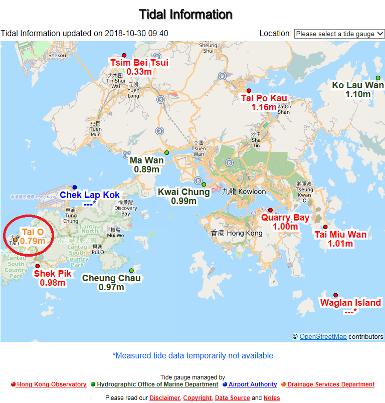
Figure 1: Newly added Tai O Tide Station (red-circled) on "Tidal Information" webpage.
Severe Typhoon Mangkhut generated severe storm surge in Hong Kong on 16 September 2018. The maximum sea level recorded at Tai O on that day reached 3.86 metres (above Chart Datum), or 2.33 metres higher than the astronomical tide (Figure 2).
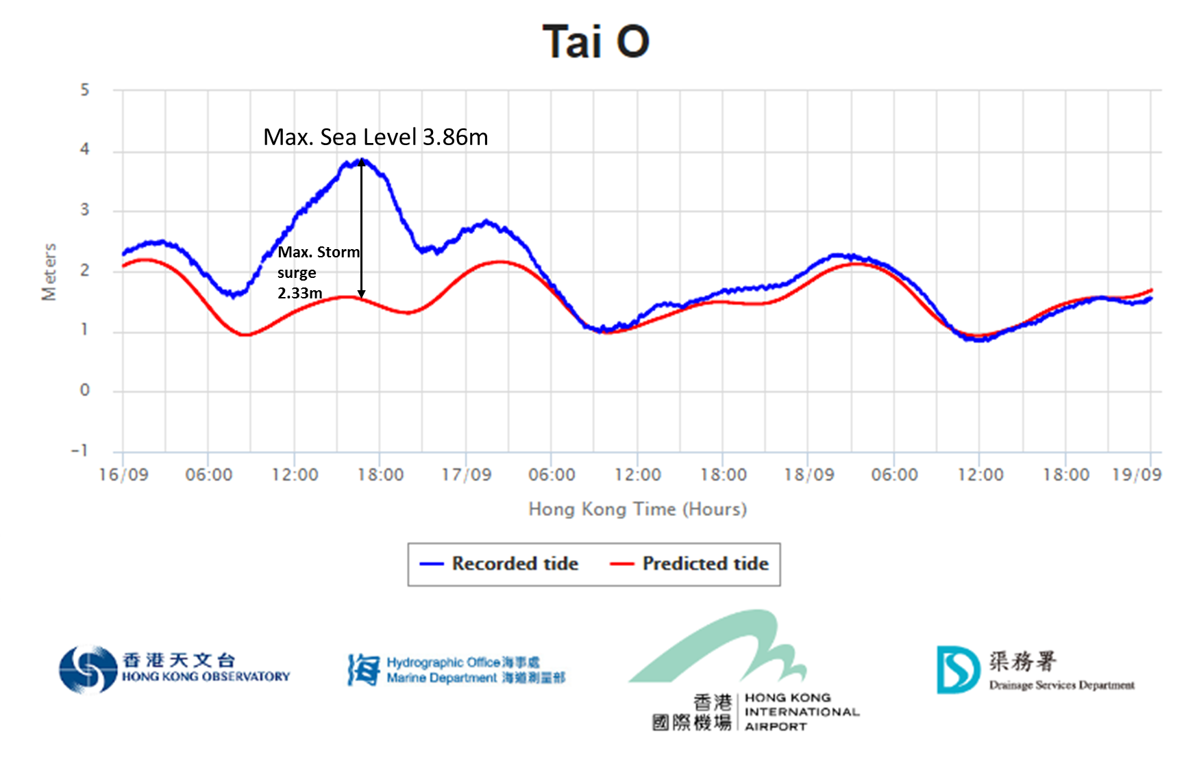
Figure 2. Variation of tide levels at Tai O Tide Station between 16-19 September 2018 during the passage of Mangkhut.
The "Tidal Information" services are accessible from the Hong Kong Observatory's webpage at https://www.weather.gov.hk/tide/marine/realtide.htm, the mobile version at https://www.weather.gov.hk/m/rt.htm or from the "MyObservatory" mobile app.