TROPICAL CYCLONES IN 2014
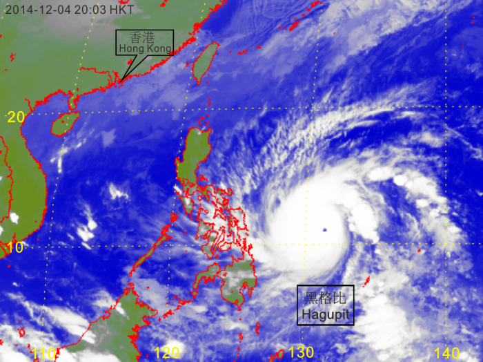
| Figure 2.4 | Infra-red satellite imagery of Super Typhoon Hagupit (1422) at peak intensity at 8 p.m. on 4 December 2014. Hagupit was centred over the western North Pacific about 1 180 km east-southeast of Manila with an estimated maximum sustained wind of 250 km/h and a minimum sea-level pressure of 905 hPa at that time. [The satellite imagery was originally captured by the Multi-functional Transport Satellite-2 (MTSAT-2) of Japan Meteorological Agency (JMA).] |